Sheet 05 · Eastern Hokkaido · Okhotsk and Kushiro · Route 243
Abashiri to Kushiro, the lake road
Some links in this article are affiliate links: if you book a car or a room through one, I receive a commission at no extra cost to you. It does not change what I recommend.
Three lakes sit in a row across the eastern side of the island, each one the flooded scar of something that blew up, and a single day of driving links all three. Two hundred and thirty kilometres from Abashiri on the Okhotsk coast to Kushiro on the Pacific — a little over three hours of actual movement, which is not the point, because the whole day is stops. You climb out of farmland onto a pass that hands you a caldera twenty kilometres wide in one go. You stand on a beach where digging a hole produces a hot bath. You look down three hundred metres into water so clear that the record it set in 1931 stood as the clearest lake measurement in the world. And you finish in a marsh the size of a small city, on the flat, with cranes in it.
This is one sheet rather than three because the road makes it one. Route 243 leaves the coast at Bihoro, crosses the rim of the Kussharo caldera and drops into it; the lake roads carry you round to Mashu; Route 241 takes you west to Akan and Route 240 south from there to the coast again. Nothing on it is difficult. The only thing that asks anything of the car is the climb to Bihoro Pass, and that is nine and a half kilometres at a little over four per cent, which any hire car will do in third without complaint.
§ 01
The pass that hands you the whole lake
Fifty-four kilometres and forty minutes out of Abashiri, Route 243 stops climbing. There is a roadside station at the top, a car park, and then the ground simply falls away and Lake Kussharo is underneath you — all seventy-nine and a half square kilometres of it, with the lava dome of Nakajima sitting in the middle like something dropped in. On a clear morning the far rim carries on into the Shiretoko peaks. On a good morning in autumn the whole caldera is full of cloud and you are looking at a white floor with an island poking through it.
The figure you will see quoted for Bihoro Pass is 525 metres. That is the lookout on the ridge above the car park. The road itself tops out at 494 metres — the profile below is the elevation model read every 200 metres along the carriageway, and 494 is where it peaks, directly over the roadside station. The difference is a five-minute walk uphill and it is worth taking, because the extra thirty metres opens up the southern end of the lake.
This is not a gated seasonal pass. Route 243 is a national highway and it is ploughed all winter; the roadside station itself stays open through to April, on shorter hours. What it does instead is close outright, at no notice, when it is blowing — this is open country at the top with nothing to stop the snow moving sideways. Check the road information before you commit to it between November and April, and have Route 391 down the east side of the lake in mind as the alternative.
§ 02
A lake you can dig a bath in
Twenty-six kilometres and twenty minutes down off the pass and round the north shore is Sunayu, which is a car park, a rest house, a campsite and a beach. The beach is the attraction. Hot water comes up through the sand, close enough to the surface that you scoop out a hollow with your hands and it fills; people bring small spades and build baths to whatever size they have the patience for. It costs nothing and nobody supervises it, which means the temperature is your problem — the water arrives hotter than you expect and the lake is right there to cool it.
The same heat is why this particular stretch of shore does not freeze. Kussharo ices over in a hard winter, and the geothermal input at Sunayu keeps a patch of it open, and whooper swans that have come down from Siberia sit in that patch all winter. If you are here in January this is where they are.
The lake underneath all this is a serious piece of water: 79.54 square kilometres, 117.5 metres at its deepest, surface at 121 metres above the sea, and the roadside-station register calls it the largest caldera lake in Japan. It has also been through something. Survey work through the twentieth century recorded it turning from roughly neutral to strongly acid — pH 4.0 by 1960, as the volcanic input worked on it — and then recovering back towards neutral by the 1980s. Nakajima, the island, is a lava dome 355 metres high with twelve kilometres of shoreline of its own.
§ 03
The bare mountain
Ten kilometres on, the trees stop and the ground turns yellow. Atosanupuri is Ainu for bare mountain, which is the whole description; the Japanese name, Mount Io, just means sulphur. It is 508 metres high and the town counts more than a thousand vents on it. You park, you walk perhaps a hundred metres across gravel, and you are standing next to steam coming out of the ground hard enough to hear, with yellow crystal built up around the openings.
Do not go further than the marked ground. The vents and the sulphur crystals are designated natural tourism resources under the town’s ordinance, and most of the mountain above the viewing area is a restricted zone under the national ecotourism law. This is not decorative signage — the crust is thin in places and the gas is real.
It was mined. Formal extraction started in 1878, peaked in 1884, and in 1887 passed to Yasuda Zenjiro, who built a railway to move the sulphur out. That railway is the reason there is a railway in this part of Hokkaido at all. The sulphur ran out and the mining stopped in 1896, eighteen years start to finish, and what is left is the smell and a hillside that has never grown anything back.
§ 04
The lake that is usually there
Fifteen kilometres up from the sulphur, the road climbs the outside of another caldera and stops at a car park on its rim. Lake Mashu is 351 metres above the sea and the wall you are standing on is between 150 and 350 metres above the water, falling away at about forty-five degrees. There is no way down to it, no road round it, and — this is the part that takes a moment — no rivers. Nothing visible flows in and nothing visible flows out. Whatever leaves does so underground.
That is why it is so clear. With no river carrying silt in, a transparency reading of 41.6 metres was taken here in 1931, at the time the clearest measurement made of any lake anywhere. It has come down since — the 2022 survey read 20.3 metres — but twenty metres of visibility in fresh water is still extraordinary, and it is what produces the colour everybody photographs. In Ainu the lake is Kamuy-to, the lake of the gods.
Mashu has a reputation for being invisible, and the reputation oversells it. The first observation deck has published its own daytime visibility rate since 2023, and outside the summer months the share of days on which the lake is in view for four hours or more between nine and four averages over seventy per cent. June and July are the bad months, when warm air over cold water fills the bowl. If you are here then, come back at midday rather than first thing: as the air warms, the cloud base lifts, and the odds improve through the morning.
The first deck — rebuilt in 2022 as Mashuko Kamuy Terrace — opens 8:30 to 17:00. Parking is 500 yen for a car from 1 May to 31 October, 200 yen for a motorcycle, and the ticket covers the Mount Io car park as well, once each, the same day, in either order. From 1 November to 30 April both are free. Pay it at whichever you reach first and keep the ticket. The third deck, four kilometres further along the rim at 670 metres, is free, higher, and looks straight at Kamuishu island, which is the top thirty metres of a volcano whose other two hundred and ten metres are under the water.
§ 05
Marimo, and the only lake in the world that makes them properly
Fifty kilometres west, through Teshikaga and over the shoulder of the Akan volcanoes, is the third lake and the busiest place on this sheet. Lake Akan is smaller than the other two — 13.25 square kilometres, 44.8 metres deep, sitting high at 420 metres — and the thing it is famous for is a plant.
Marimo are green algae that, in the right conditions, roll into balls. Ball-forming colonies exist in exactly two places on earth: here and Lake Mývatn in Iceland. Colonies of the large ones, over twenty centimetres across, exist in one place, which is this lake. They were made a national natural monument in 1921 and upgraded to special natural monument — the top tier, and the only alga to hold it — on 29 March 1952. The colonies are in Churui Bay at the north end, not off the town, and the practical way to see them is the boat: an eighteen-kilometre circuit, eighty-five minutes, 2,700 yen for an adult and 1,390 for a child, which includes landing at the observation centre on Churui island and about fifteen minutes with the marimo. It runs 1 May to 30 November, with irregular sailings from the middle of April.
Above the town on the right sits Mount Oakan, 1,371 metres. The name comes from the Ainu akam, a wheel, for the way the two Akan peaks stand up from the plain.
§ 06
A hundred and twenty people
At the western end of the hot spring strip, up a short slope lined with carved wooden owls, is Akanko Ainu Kotan: about a hundred and twenty people, a row of workshops and shops, and a theatre. It is one of the largest Ainu communities in Hokkaido and it is a living one, not a reconstruction — the carvers in the shops are working, and what they are selling they made.
The theatre, Ikor, runs traditional dance and a projection-and-dance piece built on the Akan yukar. Times and prices move by season and I am not going to quote you numbers I would have to guess at; the kotan’s own site carries the current schedule. What I will say is that an hour here changes how the rest of the drive reads. Every place name you have passed today — Kussharo, Atosanupuri, Mashu, Akan — is an Ainu word that was describing something long before anyone drew a road on it.
§ 07
The flat bit at the end
Seventy-five kilometres south and an hour later the hills give out and the land goes flat and wet. Kushiro-shitsugen is the largest marsh in Japan and it was the first wetland the country ever put on the Ramsar list — 17 June 1980, 7,863 hectares — seven years before it was made a national park, on 31 July 1987, at 28,788 hectares. This is where the red-crowned cranes are, and the reason there are still any.
You cannot drive into it, which is the point of it. What you do is stop at one of the observatories on the rim and look at a horizon of reeds with a river working its way through them, which after a day of craters and rims and lookouts is a very deliberate kind of anticlimax. Give it half an hour. Then it is a short run on into Kushiro, or twenty-four kilometres and about half an hour back west to the airport if you are flying out.
§ 08
The car, and where to sleep
This sheet is the strongest argument on the site for a one-way rental. Memanbetsu Airport is twenty kilometres and nineteen minutes from Abashiri station and thirty-nine kilometres from the top of Bihoro Pass; Kushiro Airport is at the other end. Fly into one, drive the sheet, fly out of the other, and you never repeat a kilometre. Most of the Japanese chains will do it for a one-way fee. Compare what is available at Memanbetsu before you settle on flying into New Chitose out of habit — from Sapporo this drive starts with a five-hour transit that the direct flight removes. If you do start from New Chitose anyway, Abashiri is a four-hour drive from the rental branch before any of this begins.
Two hundred and thirty kilometres is a long day if you do it in one. The natural break is in the middle, at Kawayu Onsen, which is ten minutes from Mount Io and twenty from both Kussharo and the Mashu decks, and which is strongly acidic water — the kind that leaves your skin squeaking. Rooms in Teshikaga cover Kawayu and the Mashu side. If you would rather push on and sleep at the far end, Kushiro puts you next to the airport and the marsh.
One warning that matters more here than anywhere else I have written up. Eastern Hokkaido is the worst region in the prefecture for collisions with Ezo deer: 2,340 of them in 2025, more than any other quarter of the island. About forty per cent of the annual total happens across October and November, and over seventy per cent of it between four in the afternoon and midnight. That is precisely the window in which you will be driving Akan to Kushiro if the day has run long. Slow down at dusk, expect a second and third animal behind the one you have seen, and understand that a deer in your headlights will often freeze rather than run. The same reasoning, with ice and the early dark added to it, is why I stop driving at four in winter — the four o’clock rule.
§ 09
When to go
Late September to the middle of October is the best of it: the larches turn, the caldera fills with morning cloud, and the crowds at the Mashu deck thin out. May and early June are clear and empty but cold at 500 metres. Late June and July are the fog months at Mashu and I would plan around them rather than through them. Winter is genuinely good here — swans at Sunayu, steam off the lake, the deck car parks free — but it is winter in the coldest inhabited part of Japan, and the pass will shut on you without warning.
Whenever you come, take it in the order above rather than the reverse. Going north to south you climb to the pass with the lake in front of you, get Mashu in the middle of the day when it is most likely to be visible, and arrive at Akan for the evening, which is when the kotan is awake. Going the other way you meet all three lakes with the sun in your eyes.
If you have come to this one first, the sheet that pairs with it is Noboribetsu to Lake Toya — the same geology, three hundred kilometres west, and a road that behaves very differently on it. For the drive that gets you across the middle of the island to reach either, see Furano to Biei.
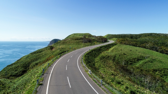
Bihoro to Teshikaga. Not a gated seasonal pass — Route 243 is ploughed all winter — but it is closed outright in a blizzard, and the summit sits in cloud on many summer mornings. The road tops out at 494 m at the roadside station; the lookout on the ridge above the car park is about 30 m higher again.
Before you go
- Fly into Memanbetsu and out of Kushiro if you can. A one-way rental turns this sheet into a straight line instead of a 230 km backtrack.
- Bihoro Pass is not gated for the season — Route 243 is ploughed all winter — but it closes without notice in a blizzard. Check the road information before you set out between November and April.
- Pay the parking once. From 1 May to 31 October it is 500 yen for a car and the ticket covers both the Lake Mashu first deck and the Mount Io car park, one visit each, the same day. Keep it. Both are free from 1 November to 30 April.
- Do not expect Mashu at nine in the morning in late June or July. The published visibility rate improves through the day as the cloud base lifts.
- Take a small towel and, if you mean it, a folding spade for the sand baths at Sunayu. There is nothing for hire on the beach.
- The Lake Akan boat runs 1 May to 30 November: 85 minutes, 2,700 yen for an adult, and it is the only practical way to see the marimo.
- Drive Akan to Kushiro before dusk if you can. Eastern Hokkaido has the worst deer collision figures in the prefecture and over 70 per cent of them fall between four in the afternoon and midnight.
- Reconfirm hours, fares and seasons before you travel. Every fee on this sheet is seasonal.
Sources, and when I checked them
- Akan-Mashu National Park, creation notice — Ministry of the Environment, Kushiro office (official) checked 2026-08-28
- Akan-Mashu National Park — Ministry of the Environment (official) checked 2026-08-28
- Lake Mashu survey data — Hokkaido Research Organization (official) checked 2026-08-28
- Lake Kussharo survey data — Hokkaido Research Organization (official) checked 2026-08-28
- Lake Akan survey data — Hokkaido Research Organization (official) checked 2026-08-28
- Lake Mashu, visibility rate and lake figures — Teshikaga Tourism Association (official) checked 2026-08-28
- Lake Mashu data sheet — Teshikaga Tourism Association (official) checked 2026-08-28
- Mashuko Kamuy Terrace, hours and parking fee — Teshikaga (official) checked 2026-08-28
- Mount Io (Atosanupuri), Ainu name, sulphur mining and access limits — Teshikaga Tourism Association (official) checked 2026-08-28
- Sunayu, Lake Kussharo — Teshikaga Tourism Association (official) checked 2026-08-28
- Michi-no-Eki Gurutto Panorama Bihoro Toge — Hokkaido roadside station register (official) checked 2026-08-28
- Marimo of Lake Akan, designation dates — Kushiro City cultural properties (official) checked 2026-08-28
- Lake Akan sightseeing boat, season and fares — Akan Kanko Kisen (official) checked 2026-08-28
- Akanko Ainu Kotan (official) checked 2026-08-28
- Ramsar sites in Japan, Kushiro-shitsugen registration date and area — Ministry of the Environment (official) checked 2026-08-28
- Japan's first Ramsar site — Ministry of the Environment, Ramsar FAQ (official) checked 2026-08-28
- Kushiro-shitsugen National Park, designation and area — Ministry of the Environment (official) checked 2026-08-28
- Ezo deer collisions, latest regional figures — Hokkaido Prefecture (official) checked 2026-08-28
- Elevation model used for the pass profile (DEM10B) — Geospatial Information Authority of Japan (official) checked 2026-08-28
- Kita-no-Michi Navi, winter and pass road information — CERI (official) checked 2026-08-28